Maui > Weather > Tsunami

Maui Tsunami Evacuation – Routes & Zones
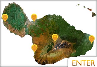
In light of the few near-misses by Tsunami’s in Maui waters in the last decade or so, we’ve decided to find some maps and put them at your fingertips more easily. Below are evacuation zones for the island of Maui. Please move to higher ground in the event of a potential tsunami. Any roads that are shown to border flood zones are thought to be safe (but we won’t really know until one hits, so use extra caution.) Below you will find individual Maui tsunami evacuation maps for each region of the island.
You can learn more about local Maui weather, Maui weather report, and Maui Tsunami History by visiting our other Maui pages.
See the latest Maui, Hawaii Tsunami Updates.
Tsunami Evacuation Maps
Important update: The maps below were last updated in 2011. Please see the official County Of Maui Evacuation Routes updated in 2013.
1. South Maui
Makena, Wailea and South Kihei
See updated map HERE.

2. Upper South Maui
North Kihei to the beginning of Maʻalaea
See updated map HERE.

3. Maʻalaea to Ukumehame
Kealia, Maʻalaea, McGregor Point, and Ukumehame Beach Park (The Pali Area)
See updated map HERE.

4. Lower West Maui
Ukumehame Beach Park, Olowalu, Launiupoko Beach Park
See updated map HERE.

25 Things To Do On Maui
5. Lahaina Area
Launiupoko Beach Park, Lahaina Town, and Wahikuli Beach Park
See updated map HERE.

6. Kaʻanapali & Napili
Hanakaoʻo, Kaʻanapali, Honokowai, and Napili
See updated map HERE.

7. Napili & Honolua Area
Napili Bay, Honolua Bay, Honokohau Bay, and Keawalua
See updated map HERE.

8. Kahului Area
Waiheʻe, Waihu, Wailuku, Kahului, Kanaha Beach Park, and Kahului Airport
See updated map HERE.

9. North East Maui
Kanaha Beach Park, Paia Town and Kuau
See updated map HERE.

10. East Maui (Hana Town)
Pailoa Bay, Hana, Hamoa, and Puʻuiki
See updated map HERE.

All of the maps above are from the County of Maui website in 2013. If the maps have changed since then, please let us know and we’ll update them.